Monday, July 26, 2010

July 23 Mt.Vernon M-29.88,T-3:01:43,AVG-9.86,EL-1104 Bellingham

I can tell I'm home as I was winding up Chuckanut Drive by the crisp cool summer breeze off the straits interrupted by our two weeks of hot summer,maybe.


A stop by my favorite bakery, Farm to Market in Edison,Wa.

Some friends I met up with in Bellingham.  Marilyn,Steve & Rascal.

The adventure never ends!


Statistics:
Miles-4,450.
Climbing-134,239'
Hours Riding-442.55


Thursday, July 22, 2010

July 20-21-22 Twisp M-28.82,T-3:08:13,AVG-9.18,El-1149. Early Winters Campground M-62.56,T-7:05:52,AVG-8.91,El-4603 Newhalem M-71.54,T-7:01:30,AVG-10.18,El-1145 Mt.Vernon

A nice static picture from the Overlook after climbing Washington Pass. I must of packed all the weight to one side of my panniers as you can tell by my lean.


Rusty rock formations as I was pedaling up the pass
Sasquatch was at my campsite. I arrived at Newhalem campgound late  yesterday and was debating on wether to stay or not. Mainly because I wanted a shower after missing a couple of days.Plus all the services were closed in Newhalem  by the time I got there. So anyway I relayed that information to the camp host and she suggested that I just take a bath in the river. Good idea! Theres some great tent sites right next to the Skagit river to. I was thinking a nice sandy shore with my tent on the beach but once I arrived at the site you can see what it was like. 10 knots of current with icy cold water and a 18" back eddy to bath in. If I slipped the trip was over.
 I held on to a small alder and got the job done but not without a icecream headache from washing my hair,cold.

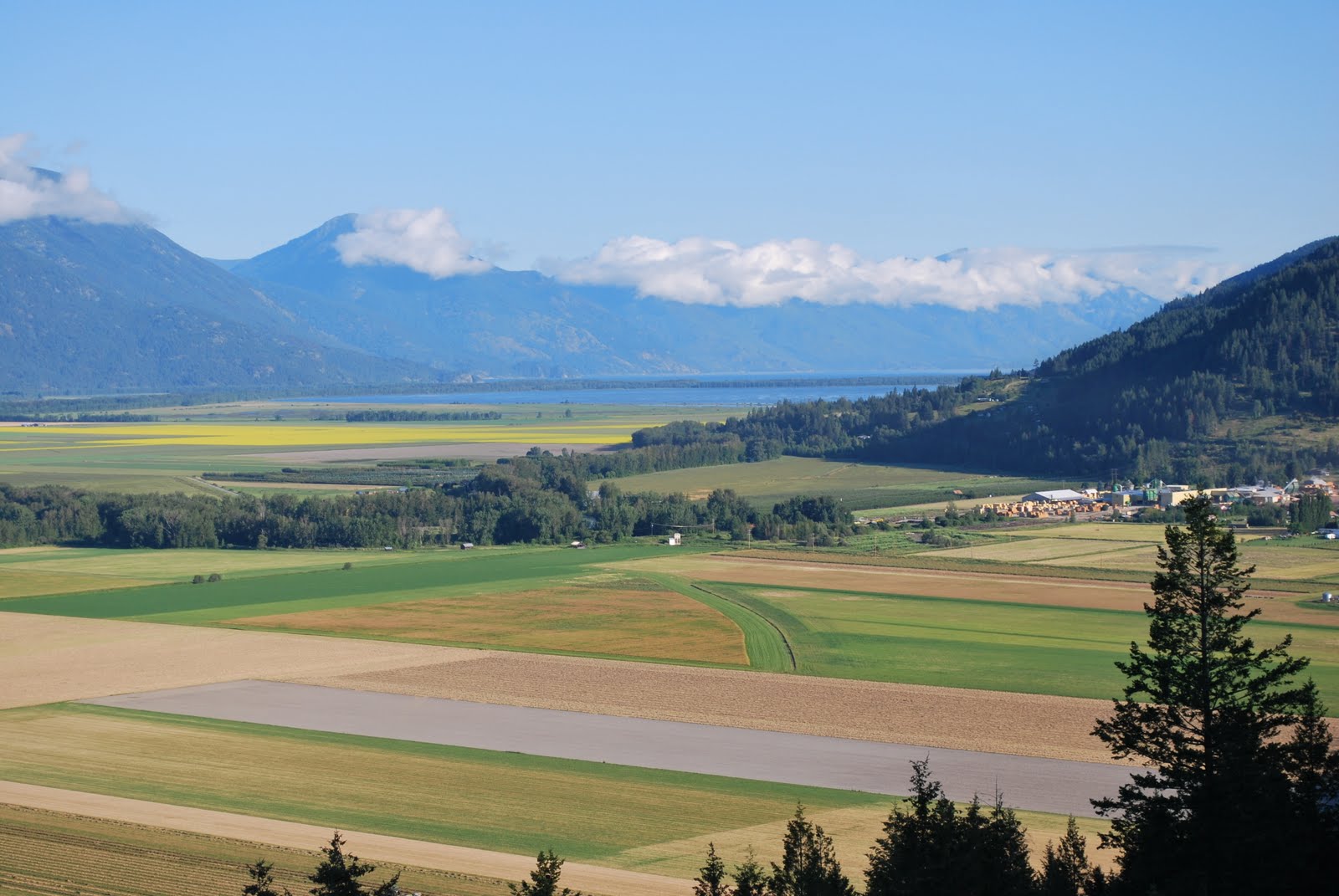
Ross or Diablo Lake.
It looks like I should easily make it to Squalicum Harbor in Bellingham tomorrow.The place I decided to wrap up my journey. I thought about this allot while riding. Going between my home on Camano Island,Anacortes or Being There my sailboat in Squalicum Harbor and I came to the conclusion to go with the sailboat. Being she's wind powered and my bike was human powered and wind powered a couple of those lucky days heading west. Also Being There was the carrot at the end of the stick through the more trying times of cycling west. Looking forward to time on the water again.
Tomorrow should be a easy ride on familiar grounds. Winding down as I head to town to  Boundary Bay Brewery around 3 for a reflective pint if you care to join me!

 I'm going to continue blogging. A few more posts about this trip and follow up with 3 of my other bike adventures. Thanks for following my journey!
Cheers Dave


Tuesday, July 20, 2010

July 18-19 Midway M-53.78,T-5:47:13,AVG-9.29,El-3218 Osooyos State Park M-74.98,T-7:50:71,AVG-10.12,El-4232 Twisp

Saturday morning leaving Midway this Osprey kept hopping (flying) one post at a time as I road along for about 10 phone poles. Always landing one pole ahead of me. It didn't land on my head either.
Back in the lovely state of Washington. After riding across the country and seeing a few states I would have to say Washington State is the most diverse when it comes to geography and climate. Osooyas State park to Omak was quite a scenic ride to a part of the state I have never been to/. You left the bussiness of Osooyas BC with it's resort atmosphere surrounding Osooyos Lake to crossing the border and entering Oroville and Osooyas State Park. Quiet and isolated with a smooth road with a wide shoulder. What else is there.
A view north from Osooyos State Park.


Saturday, July 17, 2010

July16-17 Nelson M-74.82,T-8:14,AVG-9.08,El-4692.Christina Lake M-51.14,T-5:25:13,AVG-9.43,El-2771 Midway

A lot of climbing today. More than I had realized and roughly 38 miles with no services. The first 3 or 4 miles were some what strenous, 3 to 4 mph and then it tapered off to a 6 mph climb that was manageable and went on forever. I was always anticipating the next corner to be the top for a few hours. The Kettle Valley Trail is underneath this bridge I crossed. That was an option as I was looking into it abit before I got to Castlegar but decided I'll have to come back another time.

July15-Nelson

Nelson's a cool place! A bridge you cross coming from the east after your ferry crossing from Balfour. Nelson and Fargo are my two favorite city's so far on this trip.Interesting places with there own identity which makes for some fun exploring and I could spend more time in both.
Nelson City Campground. 2 blocks from downtown with a view of the lake.

This was my spot as I came in late. The park fills up fast but the friendly park hosts made room. I had my own bench to in case I got some company.
This is a view from Giro Park. You can see the city center to the left nestled against the mountain side and fronted by Lake Kootenay

A wrought iron rail surrounding the viewpoint on Giro park. When I walked up to this park which was above the campground I didn't even notice the rail as I was entranced with the view but soon the rail became the view.


Thursday, July 15, 2010

July14 Creston-Nelson M-75.74,T-7:32:50,AVG-10:03,El-3848

Heading north up the valley to Kootenay Lake towards Crawford Bay where I will take the ferry to Nelson. Cascade Bicycle Club happened to be on the same route as I today. Inviting me over for some much needed snacks at a midmorning rest stop along the way. Thanks.

The Glass House built by a Mortician into recycling back in the 50's. Formeldahyde bottles were stacking up and he couldn't stand to see them go to waste and decided to start saving them up and to build a elaborate residence on Lake Kootenay.He also contacted fellow morticians in the interior of BC and got them into recycling cause. Offering to pick them up if they saved them so he could get the house done sooner at his wifes request.                                                                    


Ferry ride to Balfour from Crawford bay then a 20 mile ride to Nelson. With less hills.
  The penny toss as the ferry landed against one of the iron piles. Just out of reach for a free Pint!


I had to make one last comment om my ride to Creston. Scotties RV where I stayed happened to be right across the street from the Columbia brewing with tours. Kokanee is there main label and as I was taking the tour and we were  entering the packaging department I noticed the Lucky Lager logo. I can't believe I took a Lucky Lager brewery tour.

Tuesday, July 13, 2010

July13 Cranbrook-Creston M-69.01,T-6:43:03,AVG-10.27,El-1765

I'm in Creston tonight after a descending ride for most of the way here. It seemed like anyway. The number 3 is a windy road heading west. I've decided to head north up the east side of Kootenay Lake tomorrow and catch the ferry across to Balfour which will then lead me to Nelson and  back down to the #3 again or I might incorporate a railtrail close to Castlegar into this plan. I'll figure it out tomorrow.
I'm a  little anxious to get home being so close but hopefully those feelings should pass by tomorrow and I'll be back to normal in this cozy little tent. Lifes pretty good out here.

Monday, July 12, 2010

July 11-12 Eureka M-83.94,T-8:50:35,AVG-9.48,El-3574 KikomunPark M-40.45,T3:43:23,AVG-10.86,El-1468 Cranbrook

A sunday morning departure from Eureka towards Roosville B.C.
Lake Koocanusa. Which I think stands for Kootenay's Mt. range, Canada,United States of America. A joint venture reservoir lake that pretty much dissapears on the Canadian side in the winter as the water is used for generating. I had tried to take a shortcut through this region via the bridge on Lake Koocanusa but got messed up and ended up back on the border on the westside of the lake. It was nice riding with little traffic but the road ended abruptly to my chagrin. At the end of the road there once was a town,Newgate, before the reservoir was built, and you could cross the river back into the U.S. Anyway it was good riding but didn't get me in the direction I wanted to go. So today I'm in Cranbrook. The long way on 3.

The Turkey Vulture family is patiently waiting this sunday morning for there road side buffet to open.

Saturday, July 10, 2010

July 9-10 Rising Sun Park M-67.97,T-7:02,Avg-9.66,El-3416 Whitefish M-62.1,T-5:43:34,AVG-10.84,El-2103 Eureka


July 7-8 Waterton M-56.86,T-6:10:01,AVG-9.21,El-3593 Rising Sun Campground

Chief Mt. I've been looking at Chief Mt. for about 4 days now. It's following me. It always seems to be the pinnacle  of my routes. North,south,east or west. Today I got to see the North side as I was heading towards Glacier from Waterton.


Early risers taking advantage of the morning glow on St.Mary Lake.

A hike I took on the top of Logan's pass. Going To The Sun Road.


A early morning start as I headed over the pass to Whitefish.